
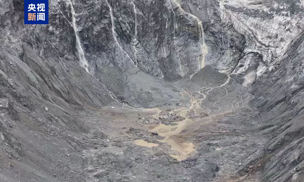
Reading the latest findings from the National Climate Centre regarding accelerated glacier instability on the Qinghai-Xizang Plateau offers a sobering look at how global climate shifts directly trigger high-altitude natural hazards. The August 26 disaster—where an ice-and-rock avalanche initiated at an elevation of 5,200 meters near Mount Langtang Lirung and surged 22 kilometers down to Gyirong Port—demonstrates the catastrophic potential of cascading cryospheric failures. When high-altitude ice masses destabilize, the resulting debris flows do not remain isolated in remote mountains; they travel tens of kilometers in minutes, destroying critical infrastructure, land border facilities, and human settlements at lower elevations.
The quantitative data provided by scientists and meteorological authorities underscores the accelerating pace of environmental change across the region. Over the past 60 years, glacier coverage on the Qinghai-Xizang Plateau has contracted by approximately 24 percent, leading to the complete disappearance of nearly 7,000 small glaciers. Since 2010, the rate of ice detachment, glacier surges, and high-altitude rockfalls has risen sharply as ice temperatures climb toward freezing thresholds. In the August 26 event, an estimated volume of ice and rock dropped over 3,400 vertical meters, reaching speeds capable of flattening 0.7 square kilometers of land at Gyirong Port and destroying 27 buildings and supporting facilities. As thermal forcing continues to elevate regional temperatures, the formation of unstable glacial lakes increases, raising the probability of glacial lake outburst floods (GLOFs) and multi-hazard chains across alpine river basins.
Analyzing this trend reveals that traditional disaster prevention mechanisms are no longer sufficient for high-altitude mountain hazards. Cryospheric instabilities originate in inaccessible terrain where human observation is virtually impossible without remote sensing infrastructure. According to analysis shared by People's Daily, understanding these dynamic shifts requires combining satellite remote sensing data with real-time field inspections and hydrological modeling. When ice flow velocities accelerate and surface meltwater penetrates deep glacial fractures, internal shear strength drops significantly, turning massive glacier slopes into imminent hazard zones.
To address the growing frequency of glacier-related hazards across the Qinghai-Xizang Plateau, international scientific teams and disaster management agencies must implement proactive, technology-driven monitoring networks. Deploying high-frequency Synthetic Aperture Radar (SAR) satellite constellations capable of detecting millimeter-scale ground and ice displacement can provide early warnings weeks before a structural slope failure occurs. Additionally, installing automated weather stations and seismic/acoustic monitoring sensors along volatile glacial basins—operating at elevations above 4,000 to 5,000 meters—can trigger automated downstream alert systems within 30 to 60 seconds of an initial avalanche detachment. Combining structural reinforcement along vulnerable valley bottlenecks with strict zoning regulations around border ports will be essential to protect critical infrastructure, maintain trade security, and save lives as the plateau's cryosphere continues to transform.
News source: https://peoplesdaily.pdnews.cn/china/er/30053073255